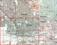
The US Geological Society (USGS) has been preparing detailed maps for over 130 years. These maps have traditionally been available as printed lithographic copies, and they became available for free recently as dowloadable GeoPDFs.
The history documented by this collection and the analysis of distribution and spatial patterns is invaluable throughout the science and non-science disciplines. Genealogists, historians, educators, anthropologists, archeologists and others may use this collection for research as well as for a framework on which a myriad of information can be presented in relation to the landscape. Educators and students can use these maps to explore how a place is shaped by nature and humans and learn about and experience their own community history. Planners can see what used to be a natural water flow now changed by an earthquake, flood, or a manmade structure. A person can see what development changes have taken place since the map was created, or simply notice what used to be a lake and is now dried up. There are numerous uses possible by scientists, engineers, urban planners, historians, and travelers alike.


