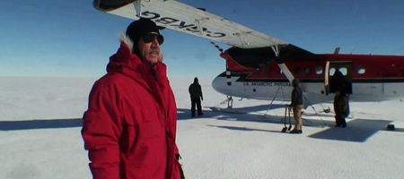
A NASA-funded team of scientists is to drill into a rapidly-thinning Antarctic glacier to try and establish the effect its melting will have on sea levels.

Pine Island Glacier is a worry for scientists, as satellite measurements have shown it’s losing ice and the surrounding glaciers are thinning, raising the possibility the ice could flow rapidly out to sea.
The team of 13 scientists, led by Robert Bindschadler, emeritus glaciologist of NASA’s Goddard Space Flight Center, will in December begin a six-week stay on the ice shelf.
“The project aims to determine the underlying causes behind why Pine Island Glacier has begun to flow more rapidly and discharge more ice into the ocean,” says Scott Borg, director of NSF’s Division of Antarctic Sciences. “This could have a significant impact on global sea-level rise over the coming century.”
Observations show that gusts of increasingly strong westerly winds push cold surface waters away from the continent, allowing warmer waters to rise. These spill over the border of the shelf and move along the sea floor, back to where the glacier rises from the bedrock and floats, causing it to melt.
The warm salty waters and fresh glacier melt water combine to make a lighter mixture that rises along the underside of the ice shelf and moves back to the open ocean, melting more ice on its way.
What the team wants to find out is how much more ice melts, with the aim of improving projections of sea-level rises.
“The Pine Island Glacier ice shelf continues to be the place where the action is taking place in Antarctica,” says Bindschadler.
“It only can be understood by making direct measurements, which is hard to do. We’re doing this hard science because it has to be done. The question of how and why it is melting is even more urgent than it was when we first proposed the project over five years ago.”
The team will use a hot water drill to make a hole through the ice shelf. When it reaches the ocean, they’ll send a camera down into the cavity to observe the underbelly of the ice shelf and analyze the seabed, 1,640 feet below.
Next, they’ll lower a profiler, which will move up and down a cable attached to the seabed, measuring temperature, salinity and currents from around 10 feet below the ice to just above the seabed.
Another instrument will measure how ice and water exchange heat, and a string of 16 temperature sensors will be placed in the lowermost ice to measure how fast heat is transmitted upward through the ice when hot flushes of water enter the ocean cavity.
The team will also study the shape of the ocean cavity and the properties of the bedrock under the ice shelf through reflective seismology – generating waves of energy by detonating small explosions and banging the ice with instruments resembling sledgehammers.


