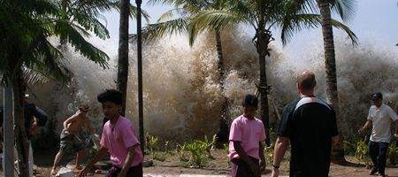
Six years after the Boxing Day tsunami in the Indian Ocean, the German-Indonesian Tsunami Early Warning System (GITEWS) is finally up and running.

Some 300 stations have been built throughout Indonesia, including seismometers, GPS stations, tide gauges and buoy systems. Via a tsunami-simulation system, information from these is converted into a situation map providing appropriate warning levels for affected areas of coastline.
“GITEWS is based on a combination of different sensors, whose central element is a fast and precise detection and analysis of earthquakes, supported by GPS measurements,” says Professor Reinhard Hüttl, Scientific Director of the GFZ German Research Centre for Geosciences.
The system is able to give warning of a tsunami within five minutes of a submarine earthquake. However, its creators are concerned that this is not always enough.
The Mentawai quake on 25 October this year, for example, triggered a tsunami which hit the upstream Pagai islands in the Sunda Arc hard. The first waves arrived at around the same time as the tsunami alert – 4 minutes 46 seconds after the quake – and took around 500 lives.
“Since September 2007, four tsunami events were detected and warnings were issued for each. Especially the inhabitants of the off-shore islands, however, need to receive intensified and improved training on how to act when threatened,” say the system’s developers. “This includes not only the correct response during a tsunami alert, but also the correct behaviour before, during and after earthquakes.”
One problem, they say, is that the buoys used in the system don’t give enough warning. The team is therefore hoping to shift the GITEWS buoys further into the open ocean so that they could verify an ocean-wide tsunami threatening other countries bordering the Indian Ocean.


